

The spine of a continent
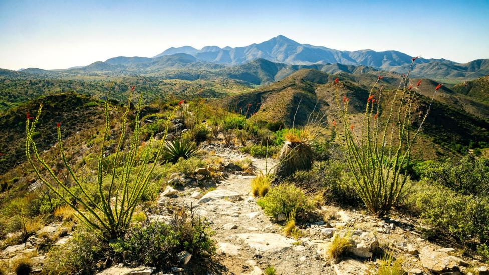
Virtually unknown outside of Arizona, the Chiricahua Mountains are the centrepiece of the North American Cordilera – the continent’s geologic backbone that extends 4,000 miles from Alaska to southern Mexico.
While plate tectonics and currently inactive volcanoes were responsible for the sharp, craggy features that define the range, the surrounding lowlands were created as the neighbouring mountain ranges began spreading apart through crustal extension. (Credit: Zack Frank)
An island in the sky
.jpg)
This raising and expanding of the land has resulted in a unique geology. The Chiricahua Mountains are a ‘sky island’ ecosystem: an isolated mountain range where the terrain, plants and wildlife are significantly different to the lowlands that surround them.
Southern Arizona is generally a dry, arid desert with few plants other than cacti, but the Chiricahua Mountains and their elevation relative to the Chihuahuan Desert below have created one of North America’s most biologically diverse areas. Atop the sky islands you’ll find hundreds of bird species, as well as deer, bears, mountain lions and other large animals that are unexpected in the deserts bordering Mexico. These animals live here, isolated, because the elevation provides the diverse landscapes of sagebrush, chaparral and pine they require to survive. (Credit: Zack Frank)
Adobe ruins
.jpg)
The Chiricahua Mountains cover an area 40 miles north to south and 20 miles wide. As people began spreading west in the mid-1800s, a path was established through the mountains to allow faster travel through the region. This path became known as Apache Pass, named for the native tribe who inhabit the mountains.
With the increase in travellers and settlers came an increase in Apache raids and attacks, causing the US Army to construct Fort Bowie. The fort was in use from 1896 through 1984, but in the years following its closure, the adobe structure saw significant decay. It’s been protected as a National Historic Site since 1972, keeping the remaining ruins from any further damage. (Credit: Zack Frank)
Apache Wars
Fort Bowie National Historic Site is designed to be experienced on foot. A trail leads visitors through battlefields and attack sites from the Apache Wars, which took place during the American Civil War. Ruins, artefacts, structures, rock formations, natural springs and even the grave of a Medal of Honor recipient pop up along the three-mile roundtrip, ending up at the park visitor centre and the site of the Fort Bowie ruins. (Credit: Zack Frank)
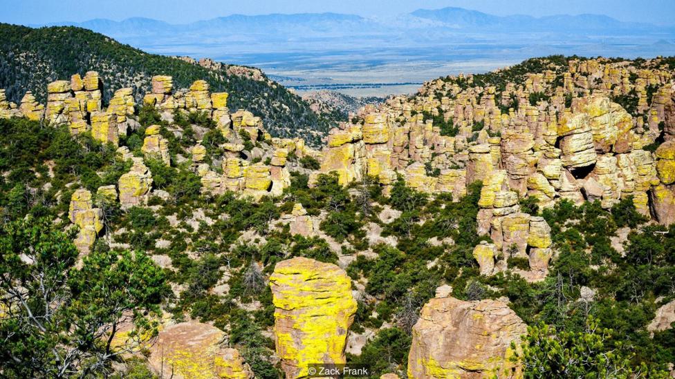
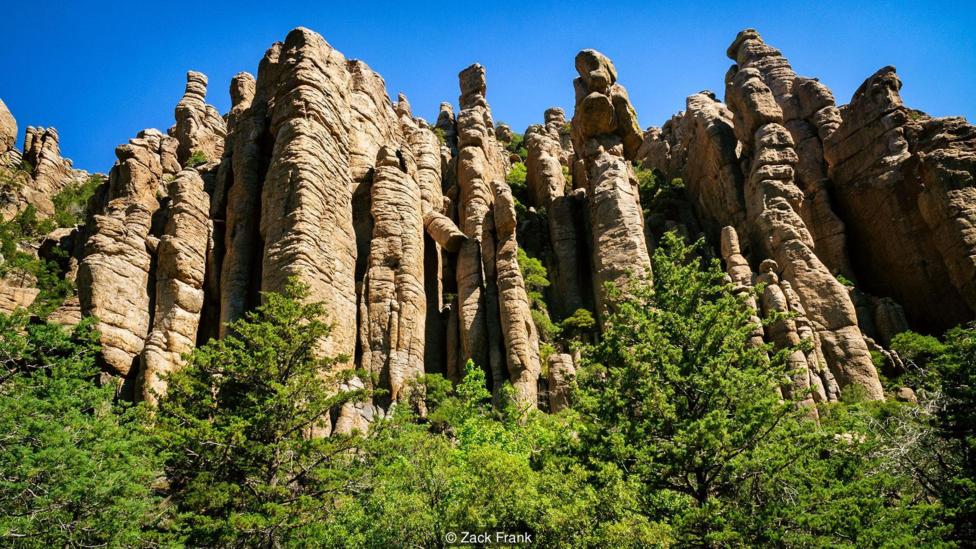
Surreal views
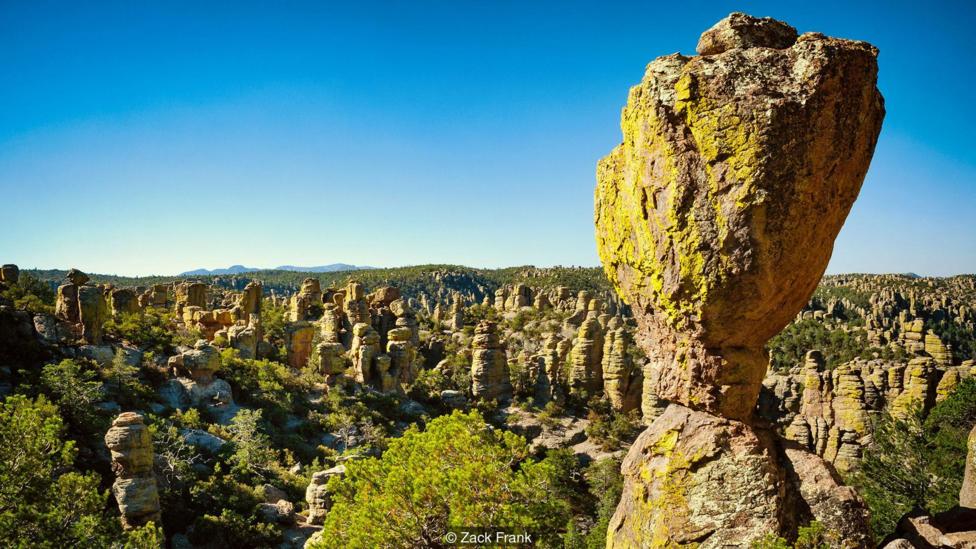
Majestic Chiricahua National Monument in the northwest of the mountains is home to surreal rock formations known as hoodoos. A high-elevation forest fills the cracks between the stone towers, creating a natural sculpture garden that expands as far as the eye can see. A strange yellow moss accents the car-sized towers, offering views like nowhere else in the country. (Credit: Zack Frank)
A scarred land
Volcanic activity, ash and erosion are responsible for the hoodoos that were carved over the last 27 million years. These forces also shaped caves, faults and canyons that fill out the adjoining countryside. (Credit: Zack Frank)
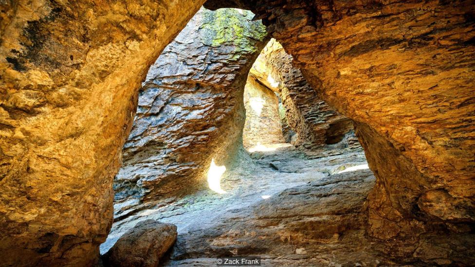
Rock tunnels
While the hoodoos above allow for amazing views, the underlying rock layers allow for exploration through human-sized passages. Amazingly, Chiricahua National Monument has never become a popular tourist attraction, so visitors will most likely have these impressive tunnels to themselves – though they should beware of the steep ravines and sharp drop-offs. (Credit: Zack Frank)
Nature endangered
Despite Fort Bowie National Historic site and Chiricahua National Monument having protection under the National Park Service, more than 90% of the Chiricahua Mountains are designated as the Coronado National Forest, meaning the land can be used for mineral extraction. The National Forest website details ongoing operations, both positive and some negative, that each cause an impact on the natural environment. (Credit: Zack Frank)
A political solution
.jpg)
Efforts to further protect Chiricahua National Monument have become part of Arizona politics. Martha McSally, Representative for Arizona’s 2nd Congressional District, recently introduced legislation to designate the monument as a national park.
If the bill passes, it will help ensure the survival of the sky islands, as well as become a substantial first step in elevating the interconnected stories of the Apaches, westward expansion and a rich geologic history to its rightful place in the American narrative. (Credit: Zack Frank)
According to bbc.com
: The oldest hatchery in the United States")

: The only National Heritage Site in the United States dedicated to preserving the Gullah Geechee culture")
: The oldest university art museum in the United States")
")